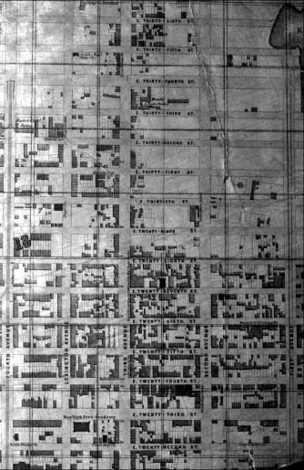

All forms of transportation used in the Rose Hill and Kips Bay area have had physical impact on this neighborhood, but none more so than the actual streets that define it. Prior to the adoption of the street grid for New York, the major route taken north from Lower Manhattan was the Bowery, which branched into Bloomingdale Road and the Eastern Post Road at the present intersection of 23rd Street and Broadway. The Eastern Post Road traveled to the Harlem River, where it crossed Kingsbridge and continued north to Boston. The road also defined the northwestern boundaries of the Rose Hill and Kip farms.
Soon after the street grid was adopted in 1811, Third Avenue was laid out and replaced the Bowery and Eastern Post Road as the major northsouth thoroughfare. By 1828, Third Avenue was paved with crushed gravel, making it one of the best-maintained roadways in New York and a favorite course for harness racing. The other principal roadways in the area, First and Second Avenues, were constructed through the East 20s by 1816. Lexington Avenue, not part of the original 1811street plan, was added in 1832 to divide the long blocks that ran from Third to Fourth Avenues (now Park Avenue South) and create more valuable street-front real estate. The major crosstown streets, 23rd and 34th Streets, initially ran through only part of the neighborhood but were extend from the East to Hudson Rivers in 1836. Most of the secondary east-west streets were in place by 1840.