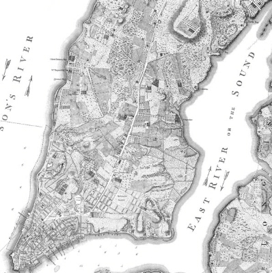
New York, 1767
Commonly referred to as the Ratzer Map after its author, this is considered
one of the most important and accurate early plans of New York. The developed
portion of New York is visible at the southern part of Manhattan. Above Grand
Street, the island consists largely of farms and country estates, each of which
is clearly drawn. The names of owners of many of these properties, such as Delancy,
Stuyvesant, Murray, Kip and Dyckman, shown on the map, have remained relevant
to New York even to this day.